GTA 6 Map Guide - Every Region of Leonida Explained
A tour of the GTA 6 map: Leonida's regions and counties, from the Keys and Grassrivers to Port Gellhorn, Ambrosia, Mount Kalaga and Vice City, plus the fog.
Skip to the guideView these places on the GTA 6 interactive map →
GTA 6 takes place across Leonida, a fictional version of Florida that Rockstar calls the Goodtime State. Rockstar names six places as the heart of it: Vice City, the Leonida Keys, Grassrivers, Port Gellhorn, Ambrosia and Mount Kalaga. On the in-game map the state is also divided into counties, and those county names are what you’ll see when you zoom out on the pause map.
This guide explains how the map is laid out, what each region is like and when the story takes you there. It’s based on the map screens from the first two chapters, Rockstar’s own descriptions of each region and PowerPyx’s county breakdown of the full map. Story spoilers are kept to the first chapters.
Regions and counties: how the map is divided
There are two layers of names on the GTA 6 map, and it helps to know both:
- Regions are the names Rockstar uses in its marketing: Vice City, the Keys, Grassrivers, Port Gellhorn, Ambrosia and Mount Kalaga. They describe the feel of an area.
- Counties are the administrative areas the map itself labels when you zoom out. PowerPyx lists five: Mariana County in the south, Vice-Dale County around Vice City, Kelly County in the north-west, Leonard County in the north-east and Lummox County along the northern border.
The counties matter in practice because guides and some in-game descriptions refer to them. Most Ammu-Nations, salons and clothing stores, for example, are in Vice-Dale County, because that’s where Vice City is. The shops and services guide uses the same breakdown.
The Leonida Keys (Mariana County)
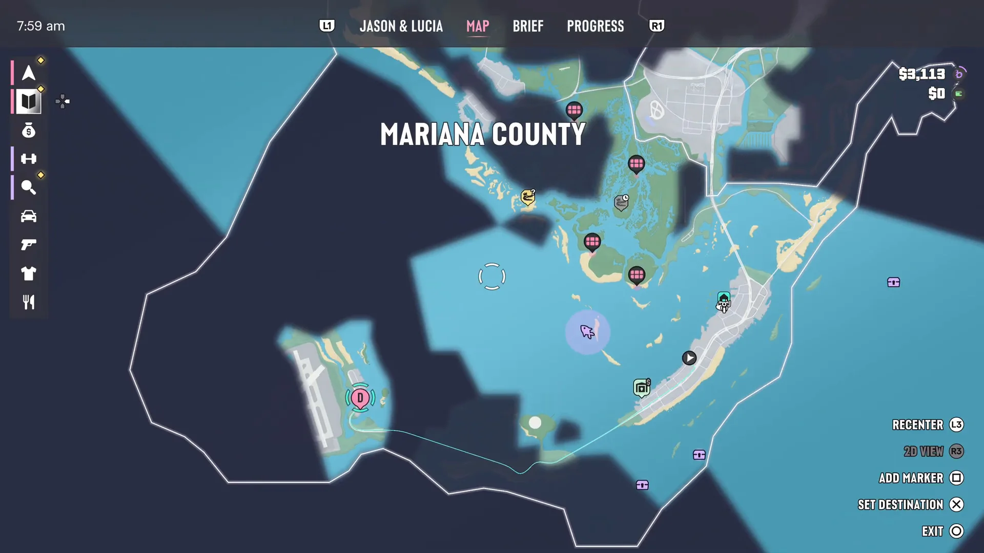
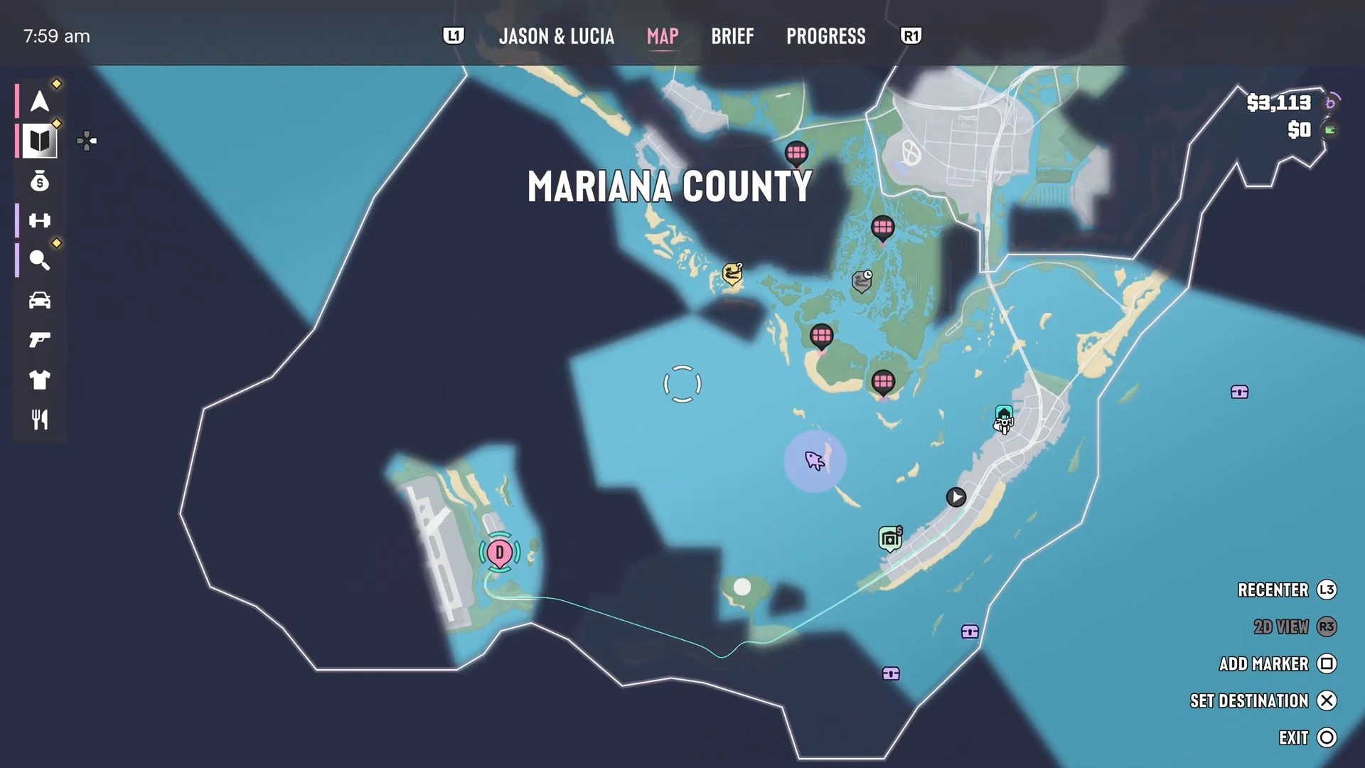
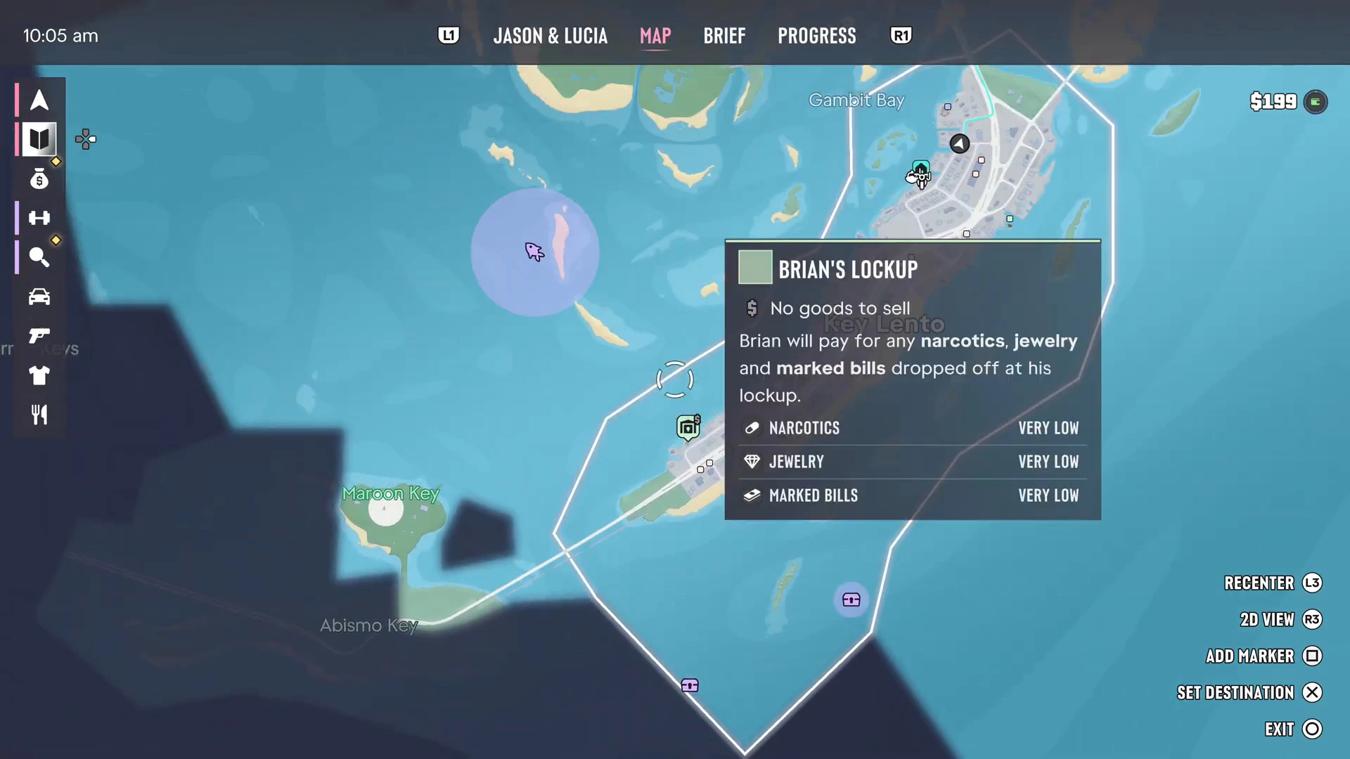
Rockstar describes the Keys as a tropical archipelago where life is easy but not flashy, right next to some dangerous waters. This is where Jason’s story begins. His house, Brian’s marina, Cal’s place, Chuck’s Tackle & Shot (the first Ammu-Nation) and Joey’s mod shop are all on Key Lento, the main island the Sunbelt Highway runs along.
The map labels plenty of smaller keys around it, including Maroon Key and Abismo Key to the south-west, and PowerPyx lists the Riquezas, Permit and Shoeless Keys too. Gambit Bay sits to the north of Key Lento, and the Leonida Straits run along the southern edge. The whole of Chapter 1 stays close to here: missions like Gone Fishing, Island Dreams and Tourist Trap are on or around these islands.
The western end of the Keys has Mile Zero Air Station, a military base. PowerPyx’s trophy notes place the Rhino tanks for the Challenging Tank trophy there, so expect a heavy response if you go in.
Grassrivers and Pelican Valley
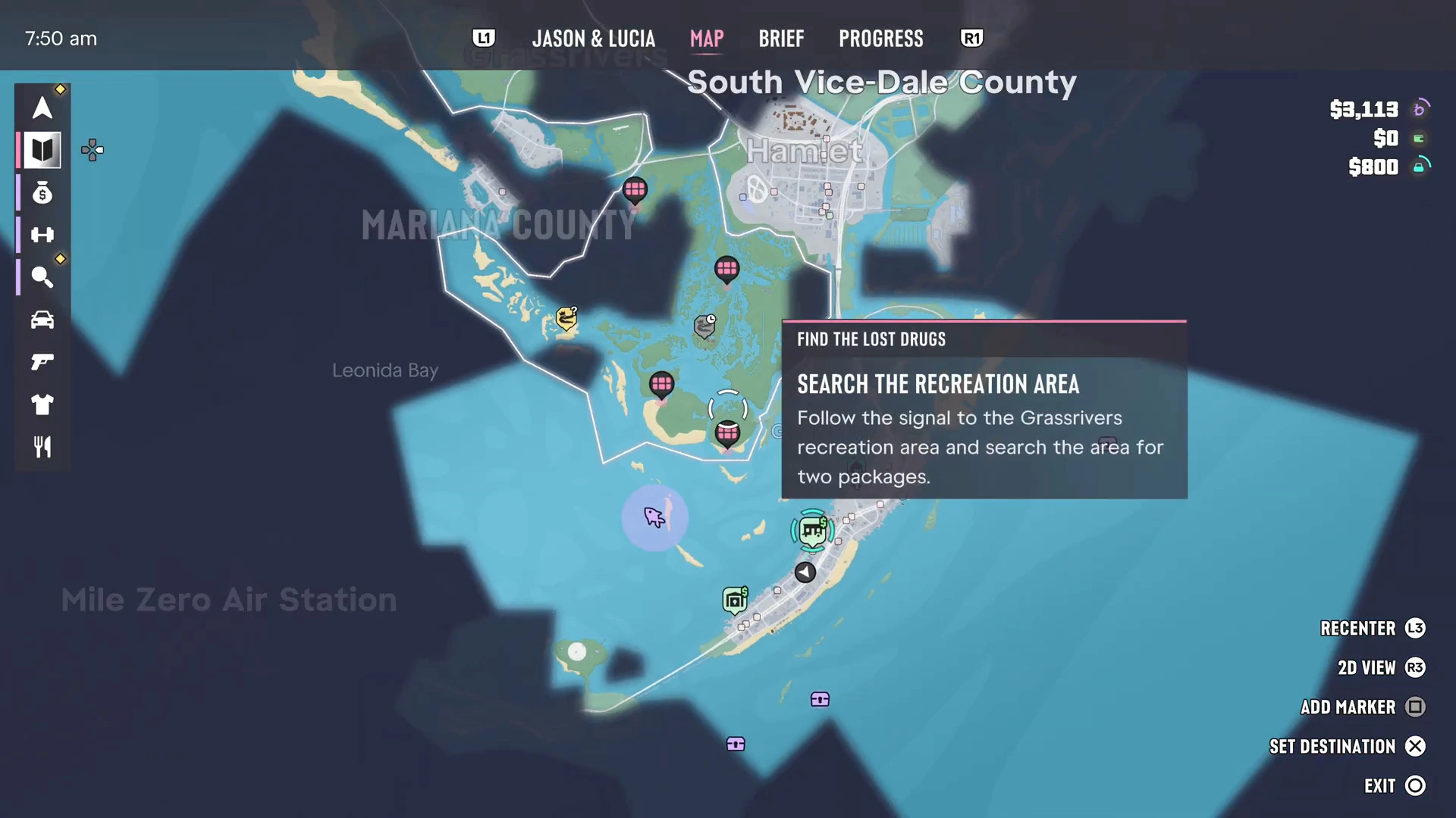
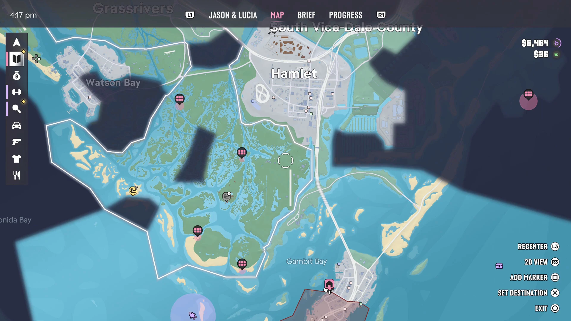
North of the Keys the map turns green and broken up by channels. This is Grassrivers, Rockstar’s version of the Everglades. Its official description promises gators and stranger things hidden among the mangroves. On the map it’s a maze of waterways between Watson Bay to the west and Hamlet to the north. Pelican Valley is the swampy area close to the Keys where the optional Find the Lost Drugs task scatters Donnie’s lost packages, and the Kingfishers gang uses the Sunrise RV Park there.
Grassrivers is best crossed by airboat or by road. The map lists a recreation area here that the story sends you to, and the region comes back in a big way at the end of Chapter 1.
Hamlet and Watson Bay
Hamlet is a town on the southern edge of Vice-Dale County, north of the swamp. The prison Lucia is released from in Coming Home is Hamlet Correctional, and Hamlet is one of the stops on the robbery spree in Breakfast Run. Watson Bay is the waterfront area to the west of Grassrivers. It’s where the Ultimate Edition’s Paradise Garage is, which Rockstar says comes with a weapon locker and a place to stash goods for fencing.
Port Gellhorn (Kelly County)
Rockstar’s description of Port Gellhorn is blunt: cheap motels, shut-down attractions and empty strip malls, in a once-popular holiday town that now runs on malt liquor, painkillers and energy drinks. It’s on Leonida’s west coast, in Kelly County.
This is where Chapter 2 is set. Jason and Lucia hole up at the Starlet Motel after Chapter 1, and missions like Girls’ Trip, Slam Dunk and Coffee Break take place around town. Moses Watkins’ car business, the pawn shop you can choose to rob in Coffee Break and the Kolts’ bowling alley from Hit Kingpin Bowling are here too. The safehouses guide covers the motel.
Ambrosia and Lake Leonida
Rockstar describes Ambrosia as the heart of Leonida, a place where industry and old-fashioned values still rule. The Allied Crystal sugar refinery provides the jobs and a local biker gang provides most of everything else. It sits inland near Lake Leonida. Rockstar also mentions a Lake Leonida off-road mod shop that is exclusive to the Ultimate Edition. Fan maps and PowerPyx’s trophy tips place Ambrosia in the north-east of the state, with a train tunnel north of town that makes a good place to lose the police.
Mount Kalaga
Mount Kalaga is a national park on Leonida’s northern border. Rockstar sells it as the place for hunting, fishing and off-road trails, with backwoods communities that keep away from the government. PowerPyx places it in the south-west of Lummox County. It’s the place to head for Bret’s hunting requests and off-road driving.
Vice City (Vice-Dale County)
Vice City is the state’s big city and the setting for later chapters. Rockstar’s description lists the art deco hotels and white sand of Ocean Beach, the bakeries of Little Cuba, the bootleg goods at the Tisha-Wocka flea market and the VC Port, which it calls the cruise ship capital of the world. PowerPyx counts around 23 named neighborhoods in the city, including Downtown, and the airport, VCIA, is here as well. Most shops and services in the game are in and around the city.
You do visit Vice City in Chapter 1, at Vice City Hospital in Discharge Time, but the story doesn’t settle there until later.
How big is the GTA 6 map?
Rockstar hasn’t published an official size. PowerPyx measured the in-game map at roughly 16 km by 11 km, about 175 square kilometres, with around 65% land and 35% water. Many buildings can be entered, and some skyscrapers have several floors you can reach by elevator.
The map fog and how to clear it
When you start, most of the map is covered by dark blue fog. It clears in segments as you travel through each area, and shops, services and locations are marked automatically once their area is clear. Clearing all of it earns The Goodtime State trophy and unlocks the Cycle Weather cheat.
More GTA 6 guides
- GTA 6 regions and counties
- How to use the map, index, waypoints and GPS
- GTA 6 safehouses: where you live
- GTA 6 shops and services
- GTA 6 trophy list
- GTA 6 beginner tips
- Every GTA 6 mission walkthrough
- Real-life locations behind GTA 6 Leonida
- GTA 6 weather and time of day